

Maritime Domain Monitor for Vessel Tracking
Maritime Domain Monitor (MDM) by Gatehouse Maritime is a powerful, web-based maritime surveillance platform for real-time and historical vessel tracking, maritime domain awareness, and operational decision support. Built for maritime authorities, coast guards, navies, and infrastructure operators, MDM brings together AIS, radar, LRIT, Methydro, and other geospatial data into a single, intuitive interface, and accessible from any browser, anywhere.
Core Features in Maritime Domain Monitor
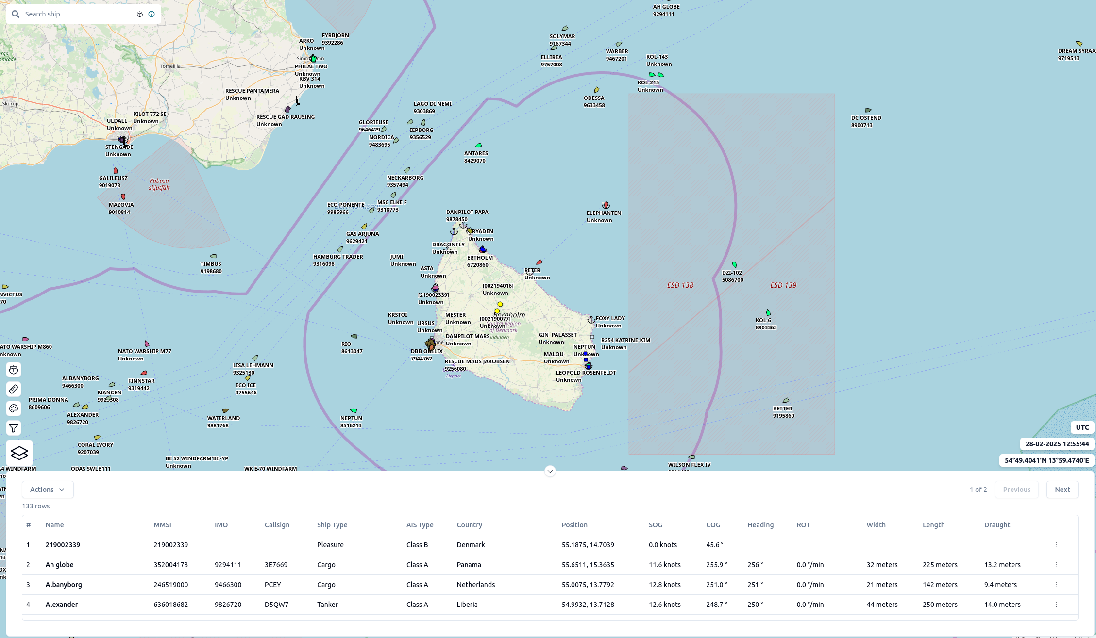
- Real-Time & Historical Vessel Tracking: Monitor vessel movements globally with an interactive map interface.
- Smart Map Layering: Switch between OpenStreetMap and S-57 nautical charts. Add custom WMS layers and vector tiles.
- Visualize support data: like beacons, buoys, and hydrography information.
- Geofencing Tools: Create, import, or export maritime zones to monitor vessel behaviour in key areas
- Custom Vessel Filtering: Filter by name, type, MMSI, zone, or user-defined lists (e.g. flagged fleets or watchlists)
- Ship List Uploads: Enable whitelist/blacklist workflows or focused fleet tracking.
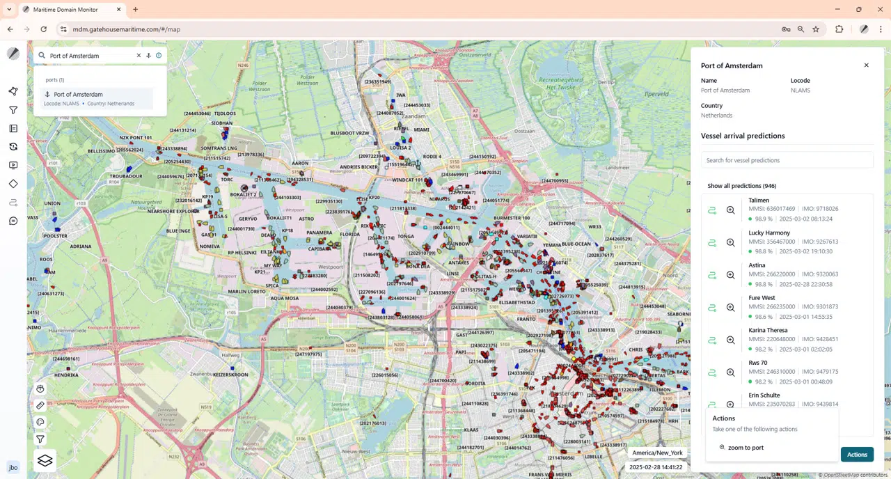
- ETA Calculation: Estimate arrival times based on custom rules and live traffic conditions.
- User-Friendly Interface: Designed for operational roles with intuitive groupings, tooltips, and minimal training required.
- Enterprise-Grade Security: Role-based access, SSO, MFA, and encrypted access support organizational compliance.
Flexible Deployment Options
You can use MDM as a standalone system. Alternatively, you can expand its capabilities by integrating it with other Gatehouse Maritime products. Integration options vary depending on your operational needs therefore, we recommend contacting us to explore what’s possible.
Seamless Integration with Your Existing Tools
Already have a preferred interface or visualization tool? No problem, because our products are also available via API. This ensures seamless integration and lets you access advanced features without changing your existing setup.
One Platform. Limitless Maritime Insight
Whether you monitor exclusive economic zones, high-risk areas, or critical infrastructure, MDM gives you full operational visibility. In addition, it adapts easily to your existing workflows.
Real-Time Maritime Domain Awareness at Your Fingertips


Tailor Your Solution with Gatehouse Maritime Products
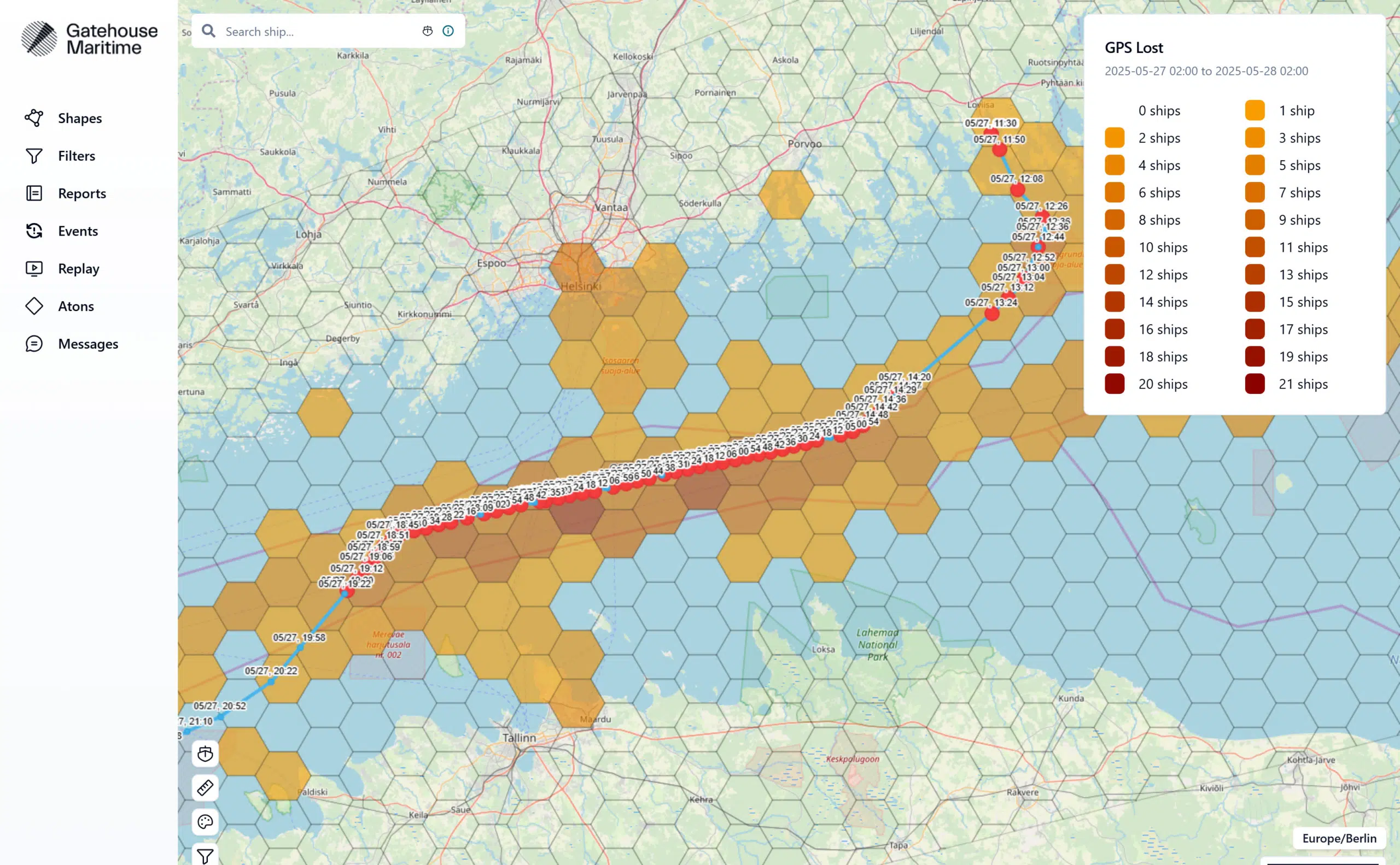
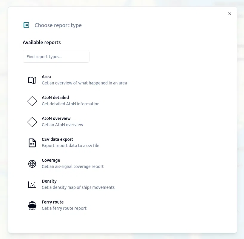
Replay and Reporting
Replay and Reporting
Unlock deep operational insights by leveraging historical AIS data. With powerful replay and reporting tools, you can assess past events, enhance preparedness, and stay ahead with real-time situational awareness.
Event Alerting
Event Alerting
Stay ahead with automated alerts and area-based monitoring. Event Alerting lets you define zones, trigger notifications, and streamline responses in real time.
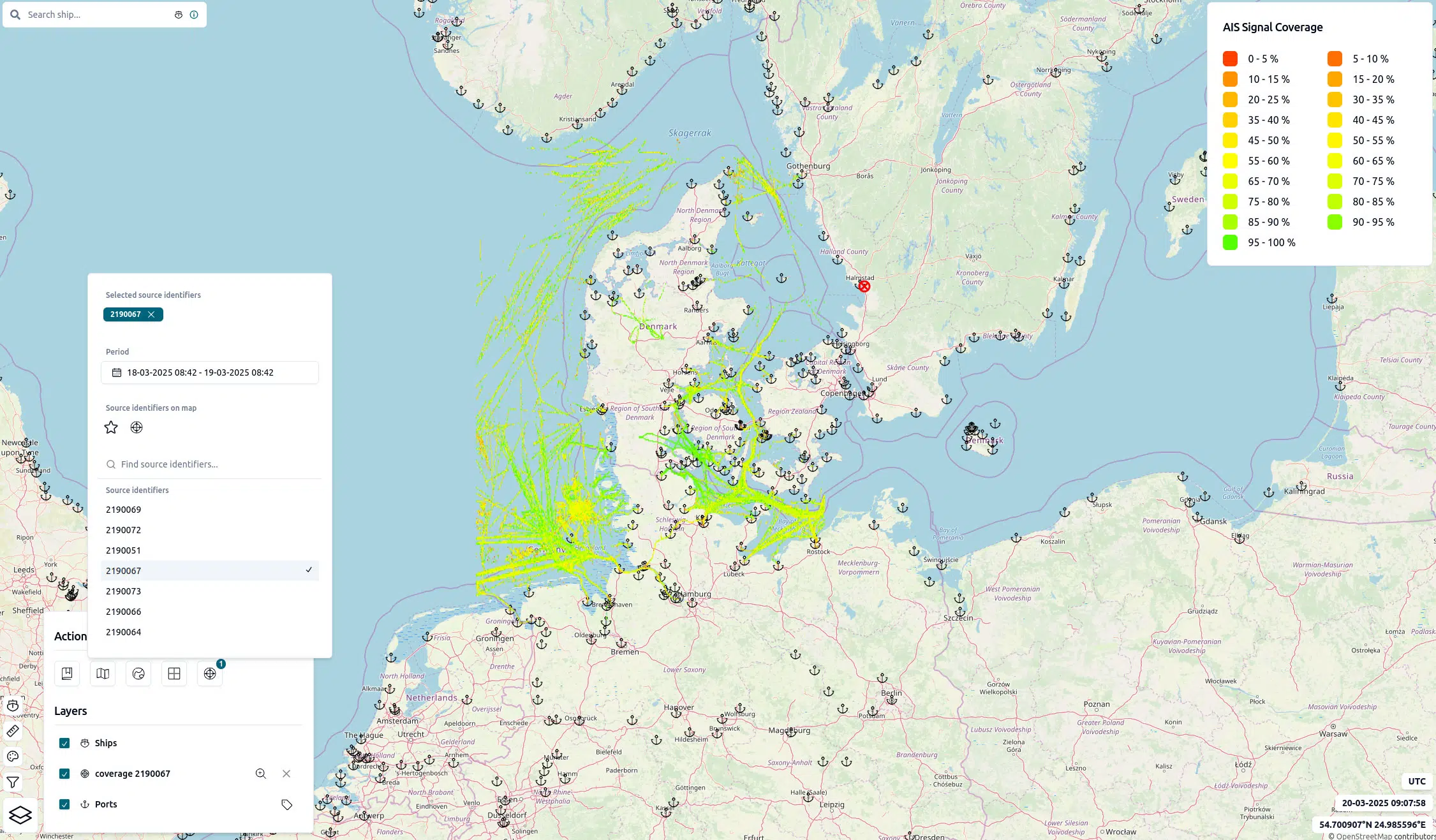
AIS Network Monitoring
AIS Network Monitoring
Stay ahead of AIS network issues with continuous monitoring and real-time alerts. Detect irregularities before they impact operations.
Aids to Navigation - AtoNs
Aids to Navigation - AtoNs
Manage virtual AtoNs and monitor physical ones , all in one streamlined solution for navigational aid oversight.
Advanced Analytics
Advanced Analytics
Advanced Analytics delivers maritime predictions powered by historical data and machine learning, turning insight into foresight.
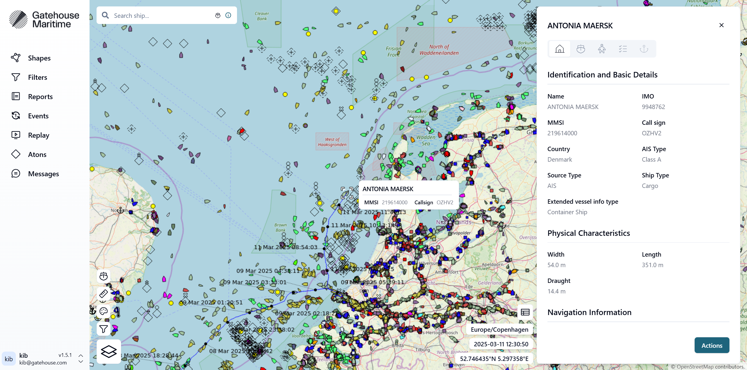
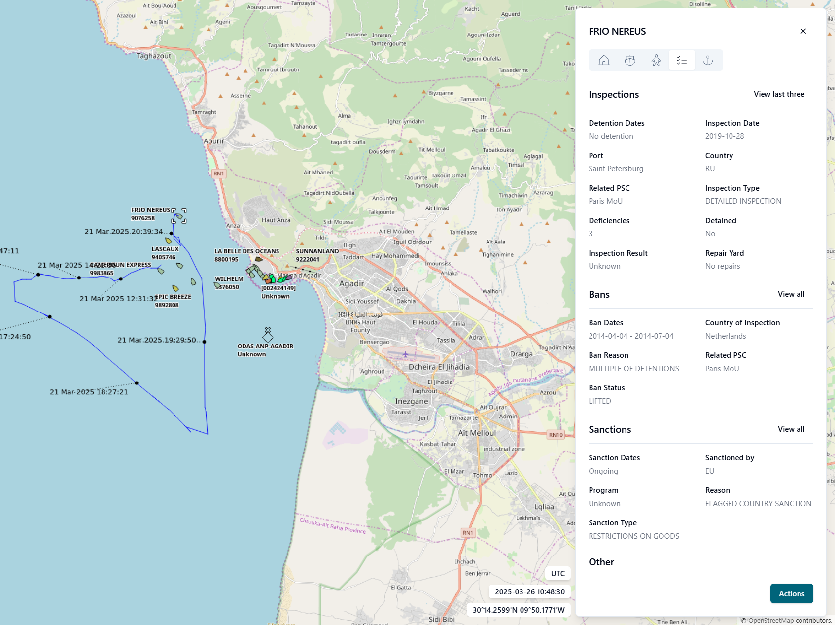
Extended Vessel Information
Extended Vessel Information
Extended Vessel Information gives you access to detailed data on any vessel — from core specs to integrity records and registry history.
Data Mediation
Data Mediation
Ensure clean, reliable AIS data delivery. Data Mediation filters, formats, and routes real-time messages with minimal bandwidth use.
Let’s get in touch

Joel Box
Commercial Director
Do you want do know more about Maritime Domain Monitor?
I’ll answer any questions you might have and show you how our solutions can benefit your operations.